Browse crosses
![]()
![]()
![]()

|
Browse crosses |
|
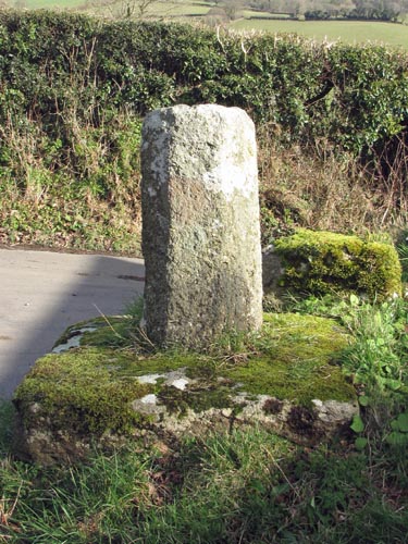 Location:
Beside the road, between
South Zeal and South Tawton, at the junction named Moon’s Cross. Location:
Beside the road, between
South Zeal and South Tawton, at the junction named Moon’s Cross.O/S Grid Ref: SX/65243/94150 Longitude/Latitude (Degrees+/-): -3.91082/50.73129 Map location: Click here to view map. Purpose: Waymarker. Size: The remaining section of shaft measures 2 feet 7 inches (0.79 metres) tall, 14 inches (0.36 metres) wide and 15 inches (0.38 metres) deep. Information: All that is left of this cross is a short length of shaft fixed in its original socket stone. The shaft is octagonal in shape and the socket stone is almost square, with the corners rounded off. It is not known when the cross was damaged, but it was in the same condition when G.W. Ormerod described it in 1874. The socket stone measures 3 feet 4 inches (1.02 metres) wide by 3 feet 6 inches (1.07 metres) deep and 10 inches (0.25 metres) in height above the ground. Judging by the size of the socket stone and the circumference of the shaft, about 4 feet, the cross must have made an impressive sight before the damage was incurred. Unfortunately, no-one has been able to trace the whereabouts of the original head and arms. |