Browse crosses
![]()
![]()
![]()

|
Browse crosses |
|
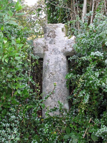 Location:
At the roadside and beneath a large ash tree near Sanduck Farm, which is
midway between Lustleigh and North Bovey. Location:
At the roadside and beneath a large ash tree near Sanduck Farm, which is
midway between Lustleigh and North Bovey.O/S Grid Ref: SX/76825/83611 Longitude/Latitude (Degrees+/-): -3.74328/50.63913 Map location: Click here to view map. Purpose: Waymarker. Size: 4 feet 2 inches (1.27 metres) high, 1 foot 6 inches (0.46 metres) across the arms. Information: This
cross was sited in its current position in 1902, having been found built
into the foundations of the Sanduck farmhouse. It appears as though there
was a fire in the 17th century farmhouse on the day of the
annual harrier hunt meet on Bellever Tor, in April 1901. Luckily the
workmen realised what they had found when the site was being cleared prior
to rebuilding. It is now thought that the cross was hidden from the
Puritans, at the time when many of the country’s religious artefacts
were being destroyed.
One arm of the cross was unfortunately missing and has had to be
replaced and it is set into a replacement socket stone. This is a
well-proportioned cross with chamfered arms and shaft. The original site
of the cross is not known, but is thought to be somewhere near its current
position. |