 Location:
At
Beatland Corner, on the bank at the side of the road. Location:
At
Beatland Corner, on the bank at the side of the road.
O/S
Grid Ref:
SX/54836/62424
Longitude/Latitude (Degrees+/-): -4.04578/50.44365
Map
location:
Click here to view map.
Purpose:
Waymarker on the ancient route taken by the monks between the
Augustinian Priories at Plympton and Tavistock Abbey.
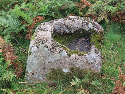
Size:
The
socket stone measures 2 feet 2 inches (0.66 metres) by 2 feet (0.61
metres) at the base and 1 foot 10 inches (0.56 metres) high. The size of
the socket is 15 inches (0.38 metres) by 9 inches (0.23 metres) and 6
inches (0.15 metres) deep.
Information: The
socket stone is all that remains of this cross. The edges of the socket
have been badly damaged over the years. Although no-one really knows
what has happened to the rest of the cross, William Crossing suggested
that this socket stone could once have held the
Shaden Moor Cross. The size and roughly shaped nature of the
original shaft
would appear to be a very good match for the socket stone. Even though
the two are now about ¾ mile apart, there are other instances on the
moor where crosses have been moved greater distances.
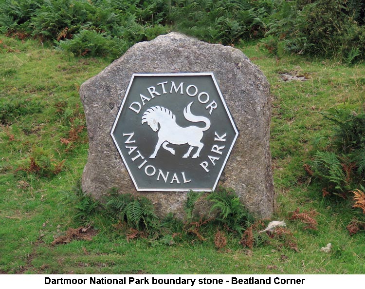
 Beatland Corner is at the crossroads of the Shaugh Prior to Wotter and
Cadover Bridge to Plympton Roads. Just a few yards from this cross
base and quite close to the road, the Dartmoor National Park have sited
a large boundary stone with their very distinct metallic logo
attached. The local pronunciation for this site
is: ‘Binlin’s Corner’.
Beatland Corner is at the crossroads of the Shaugh Prior to Wotter and
Cadover Bridge to Plympton Roads. Just a few yards from this cross
base and quite close to the road, the Dartmoor National Park have sited
a large boundary stone with their very distinct metallic logo
attached. The local pronunciation for this site
is: ‘Binlin’s Corner’.
|