Browse crosses
![]()
![]()
![]()

|
Browse crosses |
|
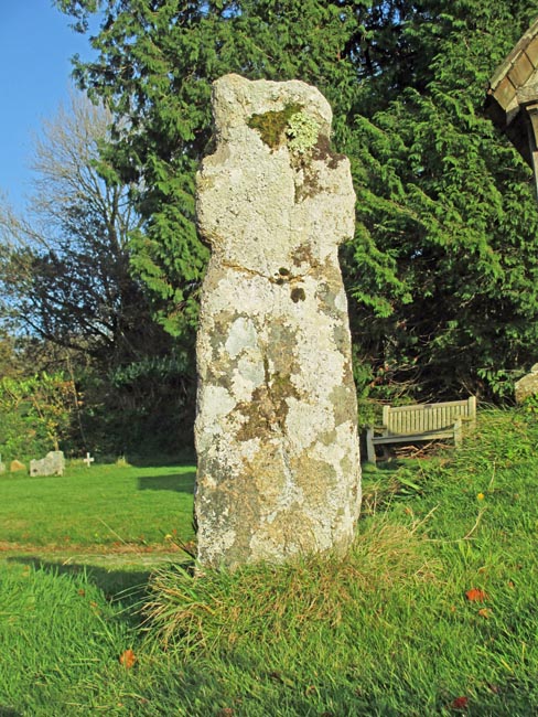
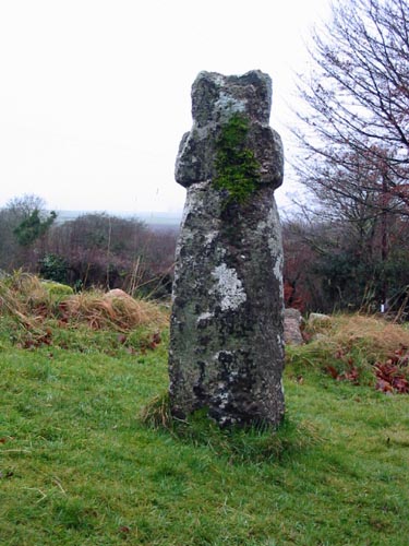 Location:
Just inside the main
entrance to the churchyard and to the left hand side of the path. Location:
Just inside the main
entrance to the churchyard and to the left hand side of the path.O/S Grid Ref: SX/63815/59421 Longitude/Latitude (Degrees+/-): -3.91831/50.41882 Map location: Click here to view map. Purpose: Waymarker on the ancient track between Buckfast Abbey and Plympton Priory. Size: 4 feet 5 inches (1.35 metres) tall. 1 foot 3 inches (0.38 metres) across the arms. The shaft is 12 inches (0.30 metres) wide by 12 inches (0.30 metres) deep. Information: This very old and rugged cross has been crudely carved from a substantial block of granite. The arms are quite short in comparison to the size of the shaft. It has been suggested that they were broken off at some point in the past, in a similar way to many other crosses that have served time as gateposts. However, in this instance the probability is that less care was taken to get the proportions right when the stone was originally carved into the shape. Further evidence of this can be seen in the way that the shaft has been tapered inwards, immediately above and below the arms in an attempt to emphasise the width of the arms.
Harford Church also stands beside the ancient track that skirts the southern edge of the moor, between Buckfast Abbey and Plympton Priory. This track, which starts at Buckfast, follows the Abbott’s Way to Cross Furzes and then skirts the eastern edge of the moor, through Moor Cross, to Shipley Bridge, over the River Avon. It then proceeds up Diamond Lane onto the open moor and veers south-westerly to Spurrell’s Cross, where it joins the east-west track across the moor from Owley Gate to the Harford Moor Gate. It then descends the Harford Moor Lane, which used to be known as the Brent Road, to Harford. On leaving Harford, it crosses the River Erme by Harford Bridge, from which parts of the current bridge date from the 16th Century. The track then passes through the villages of Cornwood, Sparkwell and Hemerdon on its south-westerly route to Plympton. It was in the Harford Moor Lane that the cross was found, being used as a gatepost. This was on the right hand side of the lane, proceeding towards the moor. This is thought to be very near to the original site of the cross, which probably served as a guide from the open moor into the lane. The cross was moved to the churchyard for safekeeping in 1909 and now shows no apparent signs of its former use as a gatepost. |