Browse crosses
![]()
![]()
![]()

|
Browse crosses |
|
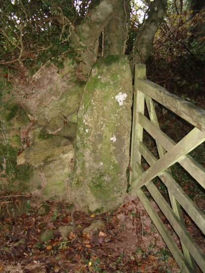
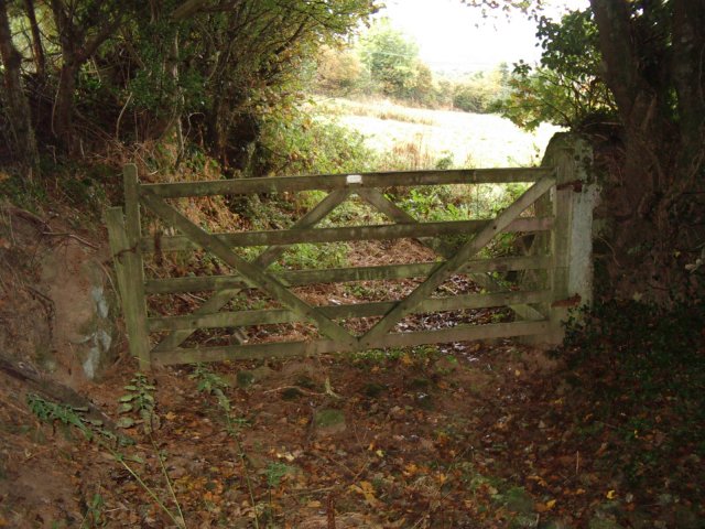
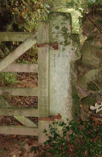 Location:
At Moor Cross, on the Cornwood to
Ivybridge road, take the lane that leads up to Hanger Farm. At the top of
the hill, take the footpath on your right and you will shortly see the
cross in a gateway on your right.
Location:
At Moor Cross, on the Cornwood to
Ivybridge road, take the lane that leads up to Hanger Farm. At the top of
the hill, take the footpath on your right and you will shortly see the
cross in a gateway on your right.O/S Grid Ref: SX/613/587 Longitude/Latitude (Degrees+/-): -3.95343/50.41175 (approx.) Map location: Click here to view map. Purpose: Not known. Size: 5 feet 1 inch (1.55 metres) tall. 1 foot 3 inches (0.38 metres) wide at the level of the arms and at the base, 1 foot 9 inches (0.53 metres) deep at the base. Information: This cross is currently in use as a gatepost at Hanger Farm. Two metal brackets have been inserted into the shaft to support a wooden gate beside the footpath leading towards the farm. Hanger Farm is in the Domesday Survey and the existing house dates from about 1600.
The other possibility to be considered is that it was erected to mark the boundary of the Blachford Estate. The manor house is situated about ½ mile to the north east of Cornwood village and its vast estate lands extend onto the moor itself. There are a number of boundary stones on the moor engraved with ‘BB’ (Blachford Bounds) and it is perfectly feasible for this cross to have performed a similar purpose on the southern boundary of the estate.
|