Browse crosses
![]()
![]()
![]()

|
|
Browse crosses |
|
 Location:
Hurdwick Farm is situated about 1¼ miles to the North West of Tavistock, on
the minor road that leads to Brentor. The cross is set on the corner of the
garden wall beside the drive leading into the farm. (Please note that
although the farm drive is also a public footpath, the cross is situated on
private property and the privacy of the owners should be respected). Location:
Hurdwick Farm is situated about 1¼ miles to the North West of Tavistock, on
the minor road that leads to Brentor. The cross is set on the corner of the
garden wall beside the drive leading into the farm. (Please note that
although the farm drive is also a public footpath, the cross is situated on
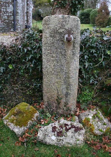
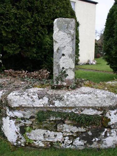
private property and the privacy of the owners should be respected). O/S Grid Ref: SX/47188/75846 Longitude/Latitude (Degrees+/-): -4.15891/50.56233 Map location: Click here to view map. Purpose: It seems probable that this cross first served as a waymarker on the route to the Tavistock Abbey. Size: The shaft of the cross is 2 feet 8½ inches (0.83 metres) tall, 10 inches (0.25 metres) wide and 7½ inches (0.19 metres) deep. Of the relief cross, the width of the shaft is 5 inches (0.13 metres), the centre of the arms is 8½ inches (0.22 metres) down from the top of the shaft and the depth of arms is 3½ inches (0.09 metres) at their narrowest. Information: Hurdwick Farm, which was once the ‘Home Farm’ to Tavistock Abbey, has a centuries old history and contains many interesting stones and relics of the past. No doubt these have been collected over many years and they provide a valuable insight into the ways of country life in times gone by. The cross is fairly unusual in that it is a regular rectangular block of granite, with a cross carved in relief on one face. This face also has chamfered edges towards the base of the shaft. Two 3 cm deep holes have been drilled into this face of the cross, indicating that it has been put to an alternative use at some time in the past, perhaps as a gatepost. The cross is now mounted on a triangular base, which also serves as a coping stone for the garden wall. This base stone measures 3 feet 11 inches (1.20 metres) wide, 6½ inches (0.16 metres) high and 23 inches (0.58 metres) deep at its narrowest point. Although now very faint, the Latin words ‘MEMENTO MORI’ (translated as: Remember that you will die) have been carved in relief along the front face of the base stone, to remind us all of our own mortality.
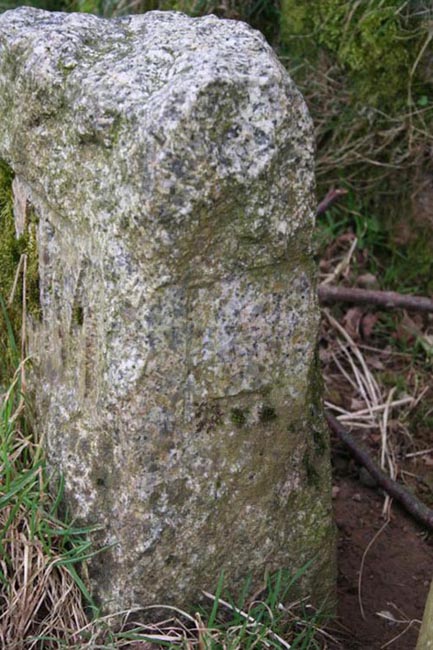
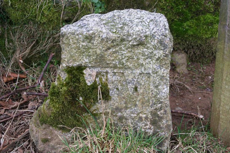
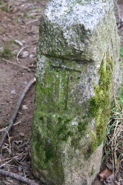
In the field next to the farm, sited closed to the hedge, is a boundary stone with the letters ‘L’ (Lamerton), ‘MM’ (2000AD) and ‘T’ (Tavistock) neatly inscribed on three faces. This is one of 28 Boundary Stones erected, or reused, by the Tavistock Town Council around their boundary to celebrate the millennium.
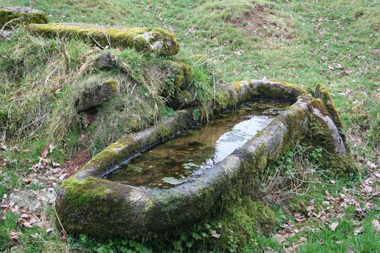
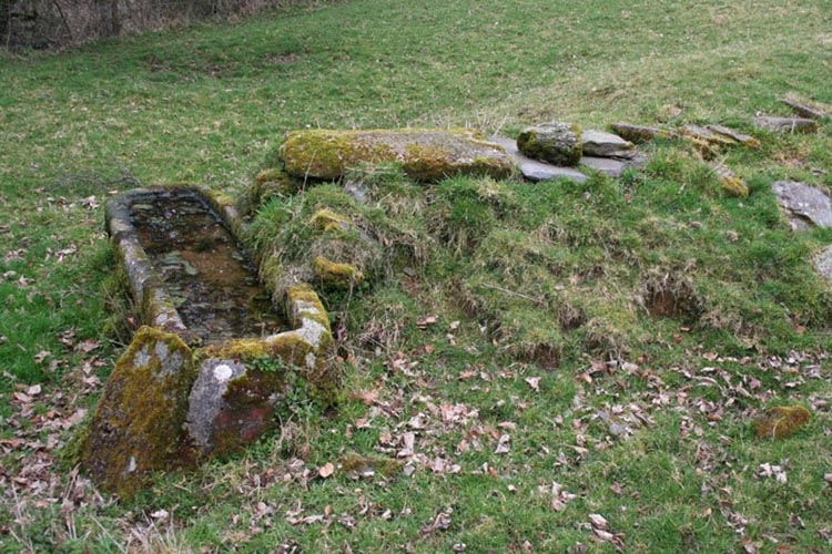
Also in the same field is a stone sarcophagus which is currently in use as a water trough. This is fed by a stone-lined water channel with no run off for the overflow, which makes the ground below it rather spongy.
|