Browse crosses
![]()
![]()
![]()

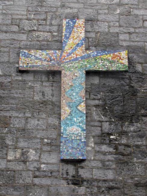
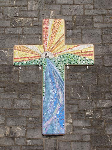
| Ivybridge Mosaic Cross |
Browse crosses |
|
 Location:
On the south facing
external wall of the Methodist Church in Fore Street, Ivybridge. Location:
On the south facing
external wall of the Methodist Church in Fore Street, Ivybridge.O/S Grid Ref: SX/63378/56032 Longitude/Latitude (Degrees+/-): -3.92323/50.38825 Map location: Click here to view map. Purpose: Decorative cross on the external church wall. Size: The cross is set too high up the wall to be measured from the ground. Information:
The original mosaic cross, on the south facing aspect of the Methodist
Church, had been showing signs of wear and damage. In 2018, it On
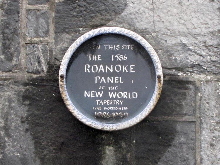
the wall, beside the main entrance to the church, sits a plaque that
records that a panel of the New World Tapestry was worked on at the
church. The New World Tapestry, which at one time was the largest stitched
embroidery in the world, even larger than the Bayeux Tapestry, depicts
English attempts at the colonisation of the American continent between the
years of 1583 and 1642. The tapestry It was the fourth panel that was worked on at this church relating to the Roanoke Colony and Fort Raleigh in the year 1586. The Roanoke Colony, also known as the Lost Colony, was based on Roanoke Island which today is in Dare County, North Carolina. The images sewn into the panel revolve mainly around the strengthening of Fort Raleigh, with two of the main scenes showing workmen sawing a large plank of wood and two others digging holes. The names mentioned in the panel include Sir Francis Walsingham (Expedition backer), Ralph Lane (Governor of the colony) and Thomas Ford (Mayor of Plymouth). Work on this panel was started in 1986 and finished in 1990. Our thanks go to Chris Taylor for bringing this cross to our attention and for keeping us updated on the replacement cross. |