O/S Grid Ref: SX/48120/81449
Longitude/Latitude (Degrees+/-): -4.14805/50.61292
Map location:
Click here
to view map.
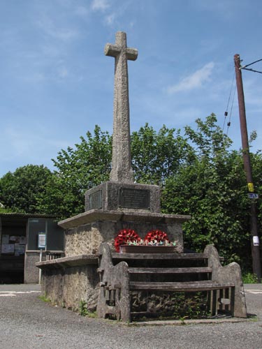
Purpose: The
cross serves as a memorial to those villagers who lost their lives in
both World Wars.
Size: The cross is 9 feet (2.74 metres)
tall, with the base of the shaft being 12 inches (0.30 metres) square.
The width across the arms measures 24 inches (0.61 metres) and the
arms have a depth of 8 inches (0.20 metres).
Information: This
elegant cross stands in a square socket on two large plinths.
The tapered shaft is square at the base and chamfered above on all
four edges, as are the arms. The base is chamfered all around
its top edge and has metal plaques bolted onto three of its faces, to
commemorate World War I. The northern face has black metal
lettering fixed direct to the stone to commemorate the one local
person who lost his life in World War II. The socket stone
measures 3 feet (0.91 metres) square and is 20 inches (0.51 metres)
high.
Both
plinths are made up of large granite blocks, with the lower one
measuring 6 feet 8 inches (2.03 metres) square and 26 inches (0.66
metres) high. The upper plinth is 4 feet 6 inches (1.37 metres)
square and 19 inches (0.48 metres) high. Both plinths are topped
off by an overlapping granite surround. A bench has been sited
against the southern face of the cross to provide a fitting place to
rest a while and think of those who gave their lives for our freedom.
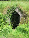
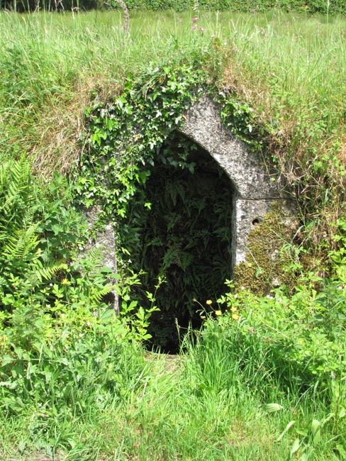
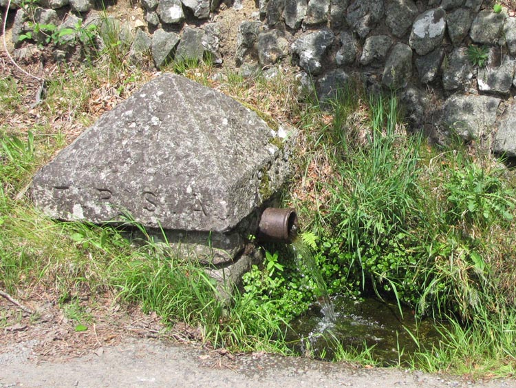
 A
short way down Station Road from the cross is a well, with a granite
surround, set back into the wall. This was the main source of
water for the villagers prior to the village being connected to the
mains water supply in the 1920's. Just below the well there is a
spring outlet that is capped off by a large pointed granite
stone. The stone is inscribed 'T. R. S. A.' along one edge, with
the date of 1893 along another and a large 'M' inscribed into one of
the sloping faces. I've not been able to discover what the
letters might represent, but this outlet must have some connection
with the old well that is just a few yards further up the road.
A
short way down Station Road from the cross is a well, with a granite
surround, set back into the wall. This was the main source of
water for the villagers prior to the village being connected to the
mains water supply in the 1920's. Just below the well there is a
spring outlet that is capped off by a large pointed granite
stone. The stone is inscribed 'T. R. S. A.' along one edge, with
the date of 1893 along another and a large 'M' inscribed into one of
the sloping faces. I've not been able to discover what the
letters might represent, but this outlet must have some connection
with the old well that is just a few yards further up the road.

 Location:
At the top of Station Road, North Brentor.
Location:
At the top of Station Road, North Brentor.