Browse crosses
![]()
![]()
![]()

|
Browse crosses |
|
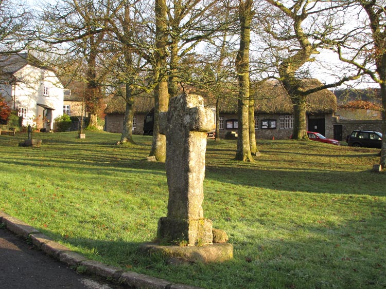
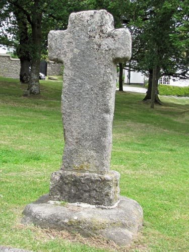 Location:
Amongst
the trees in the picturesque setting of the village green at North
Bovey. Location:
Amongst
the trees in the picturesque setting of the village green at North
Bovey.O/S Grid Ref: SX/74001/83888 Longitude/Latitude (Degrees+/-): -3.78329/50.64101 Map location: Click here to view map. Purpose: Village Cross. Size: 4 feet 2 inches (1.26 metres) tall. 2 feet 2 inches (0.65 metres) across the arms. Information: The socket stone was not made for this cross but is thought to have been in use for a much earlier and now vanished village cross. The socket was made to take a rectangular shaft with chamfered corners. Whereas, the current cross has a plain rectangular shaft that is quite a bit smaller than the socket. The current cross was found during the 19th Century in use as a footbridge across a small stream at the bottom of the village. It is thought that it originally stood near the spot where it was found to mark the track leading to a ford across the river Bovey. This restoration was arranged by the Rev. J.P. Jones, curate of North Bovey, in 1829.
|