Browse crosses
![]()
![]()
![]()

|
Browse crosses |
|
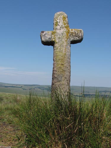 Location: Ter
Hill, just outside of the Fox Tor Newtake, on the path to Skir Ford and
Down Ridge. About 100 yards from the Ter Hill (South western) Cross. Location: Ter
Hill, just outside of the Fox Tor Newtake, on the path to Skir Ford and
Down Ridge. About 100 yards from the Ter Hill (South western) Cross.O/S Grid Ref: SX/64117/70674 Longitude/Latitude (Degrees+/-): -3.91816/50.52003 Map location: Click here to view map. Purpose: One of a number of crosses that marks the route of the Monks’ Path. This is the ancient name given to the track that links the Buckfast Abbey with those at Tavistock and Buckland. This path takes a more northerly route than the more commonly known Abbots’ Way. Size: 6 feet (1.85 metres) tall. 2 feet 2 inches (0.65 metres) across the arms Information: In the 17th Century, this cross was removed from its site by Mr Coaker, of Sherburton, where he set it up in the courtyard of his farm. Upon its discovery, the Duchy ordered him to return it to its site, which he did but left it flat on the ground. The cross was re-erected by the Dartmoor Preservation Society in 1885 but, unusually, it has been sited so that the arms are in line with the path instead of across it. |