Browse crosses
![]()
![]()
![]()

|
Browse crosses |
|
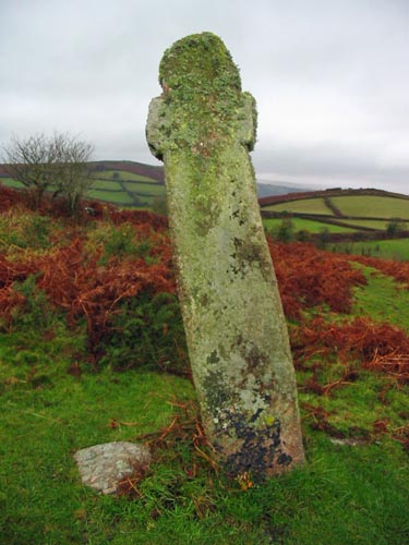 Location:
Beside
the road, leading from Chagford to Middlecott Farm, near the summit of
Week Down. Location:
Beside
the road, leading from Chagford to Middlecott Farm, near the summit of
Week Down.O/S Grid Ref: SX/71166/86542 Longitude/Latitude (Degrees+/-): -3.83282/50.68154 Map location: Click here to view map. Purpose: As a waymarker for the track from Moretonhampstead and North Bovey to Chagford. Size: 6 feet 10 inches (2.08 metres) tall. 1 foot 7 inches (0.48 metres) across the arms. Information:
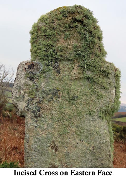
Although
firmly set in the ground, the cross is leaning over at an angle.
Each face has a Maltese Cross incised into it. The In 1867 the cross was moved back from the road slightly as the bank on which it stood was falling away. In moving the cross, great care was taken to keep the same angle to the ground as applied to its previous position. Around this time, there was also a plan to remove the cross and use it locally as a footbridge. Thankfully this plan never came to fruition. |