Browse crosses
![]()
![]()
![]()

|
Browse crosses |
|
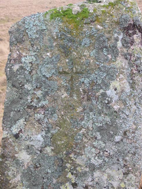
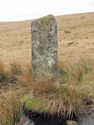 Location:
Standing
on a reave where it crosses the head of Whealam Bottom. Location:
Standing
on a reave where it crosses the head of Whealam Bottom.O/S Grid Ref: SX/61323/69492 Longitude/Latitude (Degrees+/-): -3.95710/50.50875 Map location: Click here to view map. Purpose: Although uncertain, it is likely to have been erected as a boundary marker, perhaps by the tinners of the nearby Wheal Anne mine. Size: The pillar is 5 feet 2 inches (1.58 metres) high from the top of the grass mound and tapers from 1 foot 4 inches (0.41 metres) at the top to 1 foot 7 inches (0.48 metres) at the base. The inscribed cross, which is on the North face, is 5 inches (12.5 centimetres) high and 4 inches (10 centimetres) across the arms. Information:
This
large granite pillar, which has no arms, has a cross incised on it’s
Northern face. It has been suggested that this was once a
|