Browse crosses
![]()
![]()
![]()

|
Browse crosses |
|
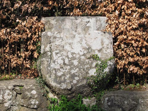 Location
: At the North end of the village of Lustleigh, on the junction which turns down to the (disused)
Railway Station. Location
: At the North end of the village of Lustleigh, on the junction which turns down to the (disused)
Railway Station.
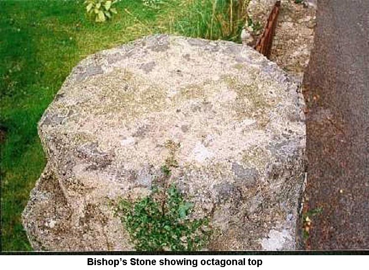
O/S Grid Ref: SX/78603/81541 Longitude/Latitude (Degrees+/-): -3.71747/50.62090 Map location: Click here to view map. Purpose: Probable base for a wayside cross. Size: The whole stone measures 3 feet 5 inches (1.04 metres) wide by 3 feet 2 inches (0.97 metres) deep and 4 feet 1 inch (1.24 metres) high, although only the top 2 feet 1 inch (0.64 metres) has been shaped. The top 8 inches (0.20 metres) of the stone has been worked into an octagonal shape. Information: This stone, which is built into the roadside wall, is thought to have been
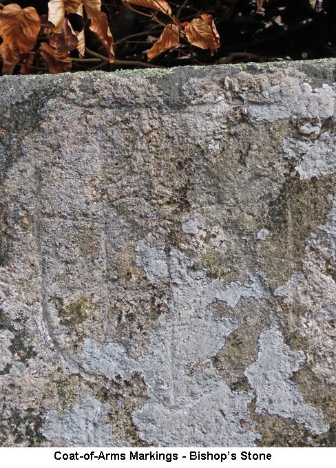
selected as a base for a cross. No socket has been cut into the top of the stone, so it must be assumed that either it was abandoned for this purpose
very early on or it was There are several theories as to how it got its name; One is that it was named after the
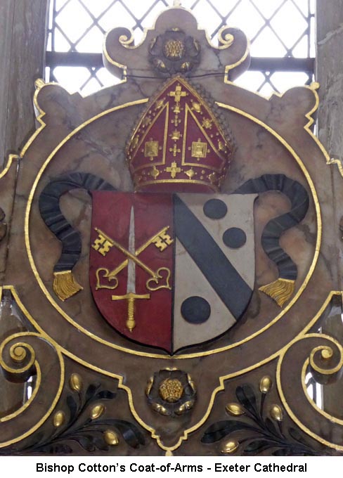
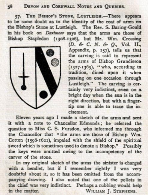
Bishop Grandisson, William Crossing, in his book 'The Ancient Stone Crosses of Dartmoor', refers to a paper written by Mr J. B. Davidson who propounds the theory that the stone marked the boundary of some episcopal land, within the See of Exeter. It is documented that there once existed a local church boundary stone referred to as the Writelan Stone, but there is some doubt as to whether it refers to this stone or another which was laid across the entrance to the south porch of Lustleigh Church, covered by a mat. The final theory is that it was used as a mustering point for the villagers, before setting off on their journey to the Abbey at Tavistock. After leaving Lustleigh, they would have joined with the residents of North Bovey and called at Hele Cross to say a prayer, before continuing their long trek across the moor to Tavistock. Our thanks to Bob Noakes for providing the information on Bishop Cotton, with the copies of the Bishop's coat of arms and the 'Devon and Cornwall Notes and Queries' paper. |