Browse crosses
![]()
![]()
![]()

|
Browse crosses |
|
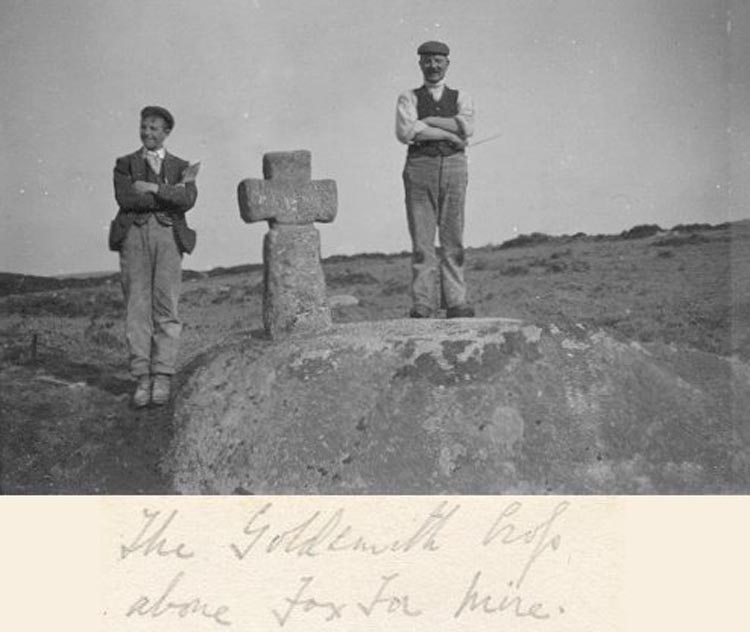
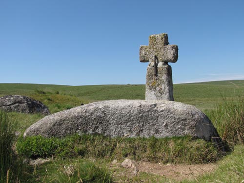 Location: Southern
edge of Foxtor Mires, about 300 yards north of the Fox Tor Newtake
boundary wall. Location: Southern
edge of Foxtor Mires, about 300 yards north of the Fox Tor Newtake
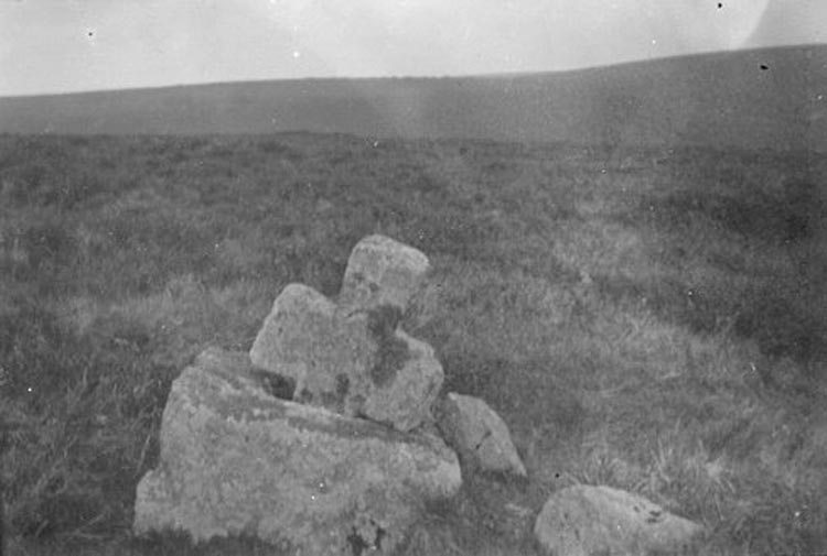
boundary wall.O/S Grid Ref: SX/61651/70163 Longitude/Latitude (Degrees+/-): -3.95273/50.51486 Map location: Click here to view map. Purpose: One of a number of crosses that marks the route of the Monks’ Path. This is the ancient name given to the track that links the Buckfast Abbey with those at Tavistock and Buckland. This path takes a more northerly route than the more commonly known Abbots’ Way. Size: 3 feet 1 inches (0.94 metres) high. 1 foot 9 inches (0.53 metres) across the arms. The shaft is 13 inches (0.33 metres) wide and 8½ inches (0.22 metres) deep. Information: This cross is named after Lt. Goldsmith R.N. who rediscovered it in 1903, after it had been lost for many years. Lt. Goldsmith was apparently out on his favourite walk whilst on leave from serving on HMS Imperial. On stopping for lunch, he happened to notice a large rectangular hole cut into the large boulder on which he was sitting. Further investigation amongst the heather revealed the head and then part of the shaft.
Drawings were made
and bearings taken and supplied to William Crossing who finally
acknowledged the newly found 'Goldsmith's Cross' in his book Guide to
Dartmoor, published in 1909. It is thought The above photographs, which I understand have not previously been published, were kindly supplied to me by Lt. Goldsmith's grandson, Commander Bill Andrew, who was recently responsible for the restoration of the Walkhampton Church House Cross. Lt. Goldsmith was also responsible for the restoration of one of the crosses on Ter Hill.
A visit to Foxtor Mires gave Sir Arthur Conan Doyle the inspiration to use the mire as the basis for his fictional 'Grimpen Mire', the favourite haunt of the infamous hound in his book: The Hound of the Baskervilles. |