Browse crosses
![]()
![]()
![]()

|
Browse crosses |
|
 Location: Approximately 400 yards
east of the summit of Gutter Tor and about 20 paces from the track leading down
in the rough direction of Ditsworthy Warren House Location: Approximately 400 yards
east of the summit of Gutter Tor and about 20 paces from the track leading down
in the rough direction of Ditsworthy Warren House
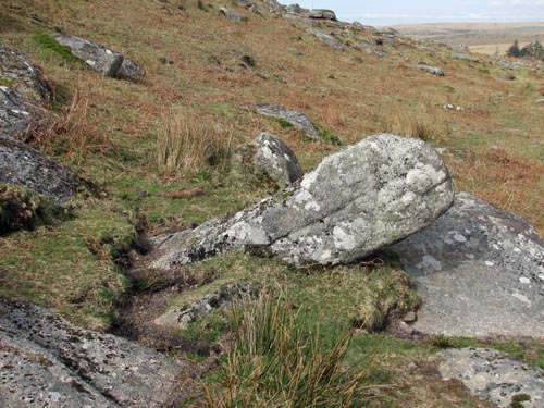
O/S Grid Ref: SX/57889/66778 Longitude/Latitude (Degrees+/-): -4.00447/50.48353 Map location: Click here to view map. Purpose: Possibly a waymarker or a boundary stone. Size: The length of the cross, above ground, is 5 feet 9 inches (1.75 metres). The width of the shaft is 18 inches (0.46 metres) and the depth is 15 inches (0.38 metres). The top of its only arm is set 8 inches (0.20 metres) down from the top of the cross and protrudes out from the shaft by only 5 inches (0.13 metres). Information: The cross was discovered by the Archaeology Unit of Plymouth University, led by Win Scutt and Ross Dean, in December 2009. The unit were surveying a medieval settlement around the slopes of Gutter Tor and stumbled across this important find quite by accident, on the very last day of their survey.
The cross, which is thought to be around 6 feet 6 inches (2 metres) long
protrudes from the ground at roughly a 45°
angle. A decorative groove has been incised along the whole length of the
shaft. In its current state, the cross has only one arm and this
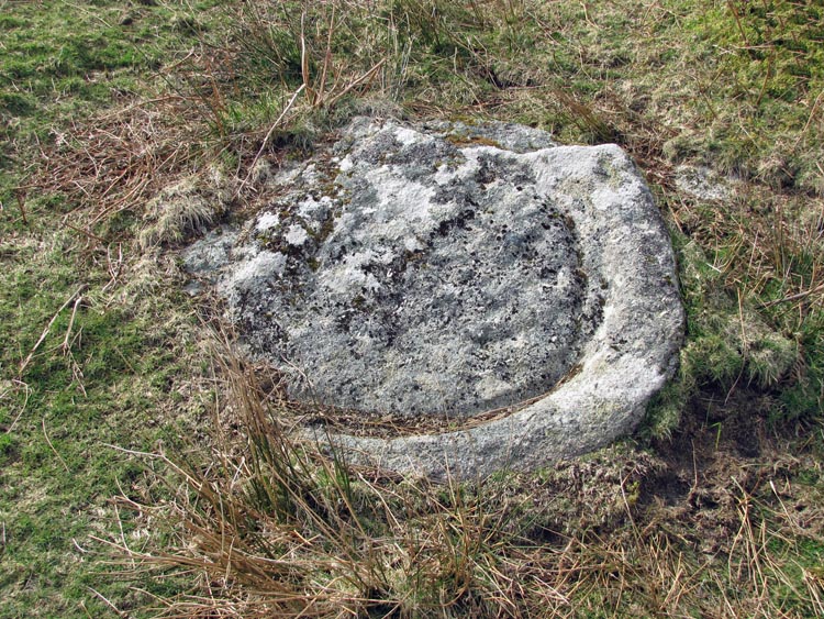
Between the path, leading down from Gutter Tor, and the cross is another interesting relic. This is a granite boulder, roughly round in shape, which has been hollowed out to a depth of a couple of inches. It would appear as though it was an attempt at creating a round trough, a small apple crusher or, perhaps, a millstone for grinding corn. No doubt it was connected with the medieval settlement and abandoned before the work on it was complete, perhaps due to a flaw in the stone. |