Browse crosses
![]()
![]()
![]()

|
Browse crosses |
|
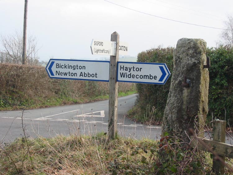
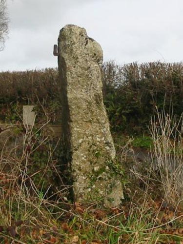 Location:
On
top of the bank, on the North West corner of Hook Cross. The crossroads is
situated about ½ mile to the North West of the A38, between Ashburton and
Bickington. Location:
On
top of the bank, on the North West corner of Hook Cross. The crossroads is
situated about ½ mile to the North West of the A38, between Ashburton and
Bickington.O/S Grid Ref: SX/77889/72654 Longitude/Latitude (Degrees+/-): -3.72463/50.54086 Map location: Click here to view map. Purpose: The Cross is likely to have been an ancient waymarker. Size: The height of the cross measures 4 feet 10 inches (1.47 metres). The shaft is 14 inches (0.36 metres) wide by 11 inches (0.28 metres) deep at the bottom and tapers upwards to 9½ inches wide (0.24 metres) by 11 inches (0.28 metres) deep at the point immediately beneath the remaining arm. The width across the shaft and the remaining piece of one arm measures 11 inches (0.28 metres). Information: I am unable to obtain any history of this cross and can only, therefore, set down my own observations from my visit to its current site.
Although the crossroads are only ½ mile from the A38, the situation is very quiet and rural. The County Council signpost, on the bank beside the cross, points the way to Haytor & Widecombe (West), Sigford (North), Bickington & Newton Abbot (East) and Caton (South). Our thanks to Sara Knaggs for bringing this cross to our attention. |