Browse crosses
![]()
![]()
![]()

|
Browse crosses |
|
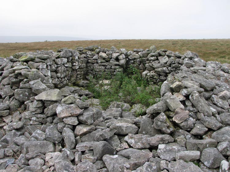
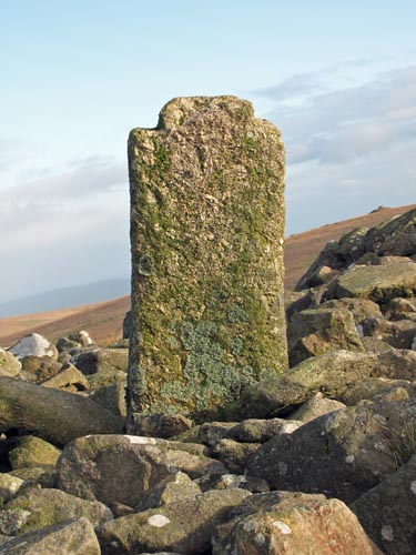 Location:
Centre of
summit cairn, Western Whitaburrow Location:
Centre of
summit cairn, Western WhitaburrowO/S Grid Ref: SX/65361/65493 Longitude/Latitude (Degrees+/-): -3.89875/50.47375 Map location: Click here to view map. Purpose: One of four crosses, erected in the 16th Century, by Sir William Petre to mark the boundary of the Manor of Brent. Size: The height, as measured from the top to as far down between the cairn stones as can be seen, is 3 feet 9 inches (1.14 metres). The width of the stone is 14 inches (0.36 metres) and the depth 7 inches (0.18 metres). Information: Sir William Petre was one of the signatories to the dissolution of Buckfast Abbey in 1539, when it was valued at the sum of £464 – 11s – 2d. He then promptly went out and bought the land belonging to the former Abbey and incorporated it into his estate. This cross was one of four that he later utilised, or had erected, to mark the extended boundary of his Manor of Brent. The other three crosses were sited at Three Barrows, Lower Huntingdon Corner and Buckland Ford, although the latter is now missing. This cross was badly mutilated in the mid 1800’s by the nearby Redlake peat cutters who built themselves a shelter out of the stone of the summit cairn. The arms were knocked off the shaft, with one arm also taking a part of the head. The shaft was then used as a chimney support for the fire built into the shelter.
|