Browse crosses
![]()
![]()
![]()

| Shaugh Prior Village Cross |
Browse crosses |
|
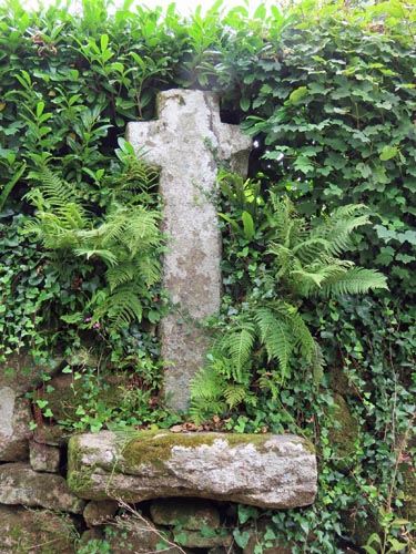 Location:
In the centre of the village, in the roadside wall of Brag Lane, just up
from the road junction. Location:
In the centre of the village, in the roadside wall of Brag Lane, just up
from the road junction.
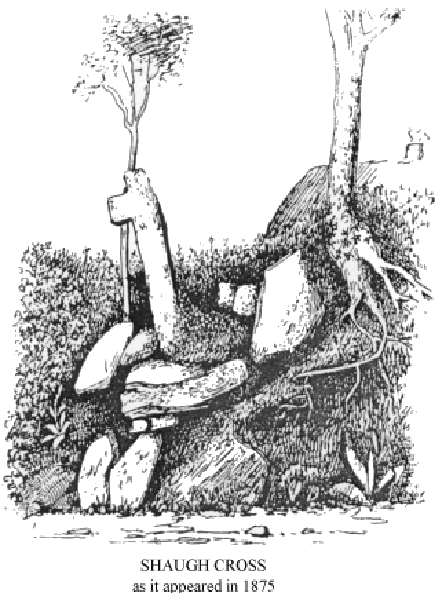
O/S Grid Ref: SX/54433/63092 Longitude/Latitude (Degrees+/-): -4.05172/50.44956 Map location: Click here to view map. Purpose: Either a Preaching or a Village Cross. Size: 5 feet 7 inches (1.70 metres) tall. 2 feet 1 inch (0.64 metres) across the arms. The shaft is 13 inches (0.33 metres) wide and 10 inches (0.25 metres) deep. Information: Both the cross and the substantial socket stone are set into the roadside wall. It will be noticed that the socket stone protudes from the wall in which it sits, having slipped from its original position over the years. The cross was originally chamfered on all edges but, due to the extensive weathering that has taken place, this is not immediately noticeable. Close examination will reveal that the right hand arm has been reattached to the cross and that a repair to the head has also been carried out. Otherwise the cross is still in very good condition. It is obviously a very old cross and therefore may have been in use as a Preaching Cross, prior to the first church being built.
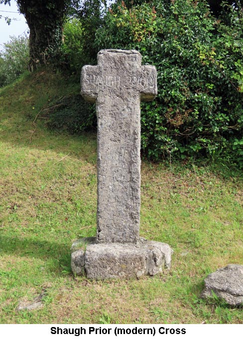
In
recent years a new cross has been erected at the roadside,
about 150 yards west of the church, and sited on the grass verge (Grid Ref:
SX/54129/63097).
However, this cross is not of ancient
origin but has been made and sited here in recent years. The cross
is composed of a synthetic material, probably fibreglass, and has been
rendered on the outside so, at first glance, it looks like a genuine
granite cross. The cross measures 5 feet 2 inches (1.57 metres)
tall, 25 inches (0.64 metres) across the arms and the depth of the shaft
is 10 inches (0.25 metres). The socket, which does appear to be made of
granite, measures 32 inches (0.81 metres) by 24 inches (0.61 metres) and 8
inches (0.20 metres) high. The
In addition to these two crosses, Shaugh Prior also has a War Memorial Cross, a socket stone and the length of another cross shaft (both included on the page for the Churchyard Cross). Our thanks go to Mark Fenlon and Paul Rendell for providing the information on the modern roadside cross in the village. |