Browse crosses
![]()
![]()
![]()

|
Browse crosses |
|
 Location:
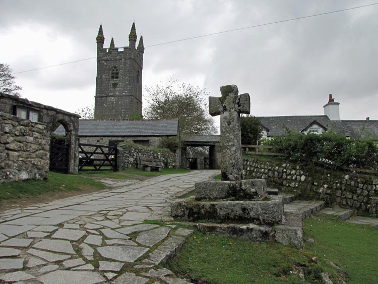
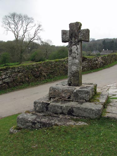
Outside the lych-gate entrance to the Sheepstor Churchyard. Location:
Outside the lych-gate entrance to the Sheepstor Churchyard.
O/S Grid Ref: SX/55961/67659 Longitude/Latitude (Degrees+/-): -4.03197/50.49098 Map location: Click here to view map. Purpose: Village Cross Size: 5 feet 4 inches (1.60 metres) tall. 2 feet 3 inches (0.70 metres) across the arms. Information: In 1902, William Crossing wrote that the base of the Sheepstor cross was lying, broken, at a nearby junction of two lanes. He also wrote that the shaft, minus the arms, was standing in a field half a mile away at Burrator, in use as a rubbing post for cattle. Previous to that it had been used as a gatepost. Happily, the cross was restored to its current position in 1910, to commemorate the Coronation of King George V. This was arranged by the Rev. Hugh Breton and a group of local Sheepstor men, who voluntarily gave up their evenings for three weeks to complete this task. The vicar of Sheepstor dedicated the cross on Coronation Day, 22nd June 1911, so that it could be used as a preaching cross and open-air services could be held before it.
There is some uncertainty about the origins of this cross. One theory is that it might originally have been known as Rumon’s or St Rumon’s Cross and it has been referred to as Roman's Cross on Ordnance Survey maps. Richard Hansford Worth suggested that it might have been the Smallacombe Cross, which stood on Ringmoor Down to mark the boundary of the Buckland Abbey lands. However, it is just as feasible that it has always been the Sheepstor Village Cross.
Nearby, at the top of the lane leading from Burrator Lodge to Welltown, at the junction with another hilly lane is a grassy mound. Although there is no cross there now, it is widely accepted that this was the site of Lowery Cross. In the churchyard, you can also see the Sheepstor Churchyard Cross and the War Memorial Cross. |